Boulder-Creek.com Weather
Current
|
Radar
|
Forecast
Updated:
5:00am PDT 7/29/26
Observed at
Boulder Creek, CA
Temperature
53.9
°F
Humidity
91
%
Dew Point
51.3
°F
Wind
N
at
0
mph
Pressure
29.87
in.
Steady
Comfort Level
Cool
Visibility
mtr011KPAO
miles
Clouds
mtr012KPAO
K feet
Today's Max
57.6
°F at
12:00am
Today's Min
53.9
°F at
4:54am
Rain Year/Month
53.61
in.
/0.00
in.
Sunrise
6:13am
PDT
Sunset
8:20pm
PDT
Moon Rise
8:40pm
PDT
Moon Set
6:06am
PDT
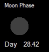
Moon Phase
Boulder Creek, CA
Current Radar
Zoom into radar image
Santa Cruz Zone Forecast
Update: 2:00AM PDT on 07/29/26
REST OF TONIGHT
Mostly clear. Lows in the mid 50s to lower 60s. Northwest winds up to 5 mph.
WEDNESDAY
Sunny. Highs in the upper 60s to lower 80s. West winds up to 5 mph.
WEDNESDAY NIGHT
Mostly clear. Lows in the 50s to lower 60s. Northwest winds around 5 mph in the evening...becoming light.
THURSDAY
Partly cloudy in the morning then becoming sunny. Highs in the lower 70s to mid 80s. West winds up to 5 mph.
THURSDAY NIGHT
Clear. Lows in the 50s to lower 60s. Northwest winds around 5 mph in the evening...becoming light.
FRIDAY
Sunny. Highs in the mid 70s to upper 80s.
FRIDAY NIGHT THROUGH TUESDAY
Mostly clear. Lows in the 50s to mid 60s. Highs in the 70s to 80s.
Scientific forecaster discussion (NWS)
Find the Weather for any
City
,
State
or
Zipcode
, or
Country:
Copyright © 2005
The Weather Underground, Inc.
Station Data from
KCABOULD3
Questions or Comments, please use our web form at
Boulder-Creek.com